What is the Wusun Ancient Road?
The Wusun Ancient Road refers to the ancient route from Wusun country to Qiuci country, crossing the north and south of the Tianshan Mountain. This road serves as the passage connecting the Junggar Basin in the north and the Tarim Oasis in the south. Throughout history, it has been a coveted territory, fiercely contested by many nomadic groups.
Emperor Wu of the Han Dynasty allied with Wusun to combat the Xiongnu. During the Sui and Tang Dynasties, Western Turkestan controlled the Tianshan Mountain and governed the Tarim Basin. The Tang Dynasty's conquest of Turkestan in the west and its friendly relations with Tujishi were made possible through the Wusun Ancient Road.

Why is it called the Wusun ancient road?
The Wusun tribe originally lived in the Hexi Corridor. The Xiongnu tribe influenced them to move westward, so they entered the Ili River Valley through a little-known passage in the hinterland of the Tianshan Mountains. They drove away the Darouzhi people who had migrated there due to the Xiongnu's expulsion. The Wusun tribe prospered in the fertile grassland of the valley, with thriving livestock and people, and became the largest country among the thirty-six countries in the Western Regions at that time, known as Wusun Country. Historical documents refer to the route they took as the "Wusun Ancient Road" during their westward migration.
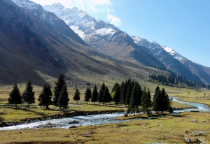
Broad Wusun ancient road & Narrow Wusun ancient road
The ancient Wusun road is divided into three routes: east, west, and middle. The east route has been developed as National Highway 217 (Duku Highway).
The western route runs from Zhaosu in Yili to Wensu in Aksu and is now known as the Xiate Ancient Road. This route is steep and rugged, making it highly dangerous. It is only passable for 2-3 months a year due to snow in winter and surging rivers in summer.

The Wusun Ancient Road, also known as the middle line, begins north of Qiongkushitai in Tekes County or the Hot Spring Line and ends south of Heiying Mountain in Baicheng County. It spans a total length of 120 kilometers and remains open for over half a year annually.
The Wusun Ancient Road is not only an ancient route connecting the southern and northern Tianshan Mountain, but also serves as an important offshoot of the Silk Road traffic system, linking the prosperous Tarim Basin by crossing the Tianshan Mountain.
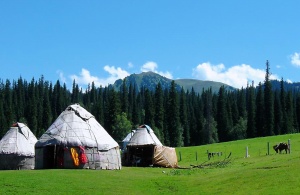
What happened in Wusun Ancient Road?
(1) Migration of the Wusun:
Originally living in the Hexi Corridor, the Wusun were forced to migrate westward due to the threat of the Xiongnu, along a little-known corridor into the Yili Valley in the hinterland of the Tianshan Mountains.
There, they drove out the Darouzhi, who had also migrated due to the expulsion of the Xiongnu, and settled in the grasslands of this fertile river valley, where they prospered and eventually became the largest of the 36 states in the Western Regions that time, the state of the Wusuns.
(2) Peaceful marriage:
In 105 B.C., the king of Wusun Liejiaomi to the Han Dynasty requested peace, han emperor Wudi to Jiangsu princess Xijun married Wusun. Four years after the death of Princess Xiaojun, Princess Jieyou married again to continue to take this road of peace. Princess Jieyou and her maid Feng smartly maneuvered around the tribes to make connections and courtesy, and the love story of Princess Jieyou's daughter, Princess Di Shi, who traveled through the Wusun ancient road to meet with the King of Qiuci, Jiangbin, for a banquet and dance, was a household story among the grassland families. Western Han's policy of peace for the promotion of mutual understanding of the various ethnic groups and tribes and enhance mutual trust played a huge role in laying the foundations of the later central government governing the Western Region of the political pattern of unity, set off the prelude to the unprecedented prosperity of the Silk Road.
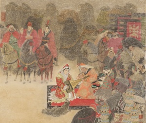
At the beginning of the 5th century, Wusun was invaded by Roran, and after moving south to Conglin, it integrated into the local tribes and stopped establishing a state.
With the rise of the Turkestan people, in 580, the Turkestan set up a small khan in the western region, in charge of the area west of the Altai Mountains, and then gradually split into Western Turkestan and Eastern Turkestan. In 648, the Tang general Guo Xiaoke defeated the Qiuci, and moved the capital of the Western Anxi to Qiuci, cutting off the Western Turkestan military and material channels. 657, the Western Turkestan was destroyed.
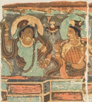
In 708, a group of Western Turkestans, the Turks, re-emerged in their homeland of Wusun. Their westward expansion, they defeated the army of the Giant Eclipse Empire, which was eager to move eastward, and were called the “Bull of Central Asia” by their strong fighting power, and obtained the status of the Tang Dynasty's vassal state, which was equal to the Later Turkic Khanate. The ancient road of Wusun played an active role as a border passage in the relatively friendly exchanges between the two sides for a long period. The Wusun ancient road played a positive role in the relatively friendly exchanges between the two sides during the period as a border passage.
After the Song and Yuan Dynasties, with the continuous development of commercial trade and road traffic, mountain passages do not have the carrying conditions of large-scale transportation disadvantages highlighted, Wusun ancient road gradually faded from the stage of history.
(3) Liu Pingguo, the left general of Qiuci, built a city by cutting a pass in the fortress:
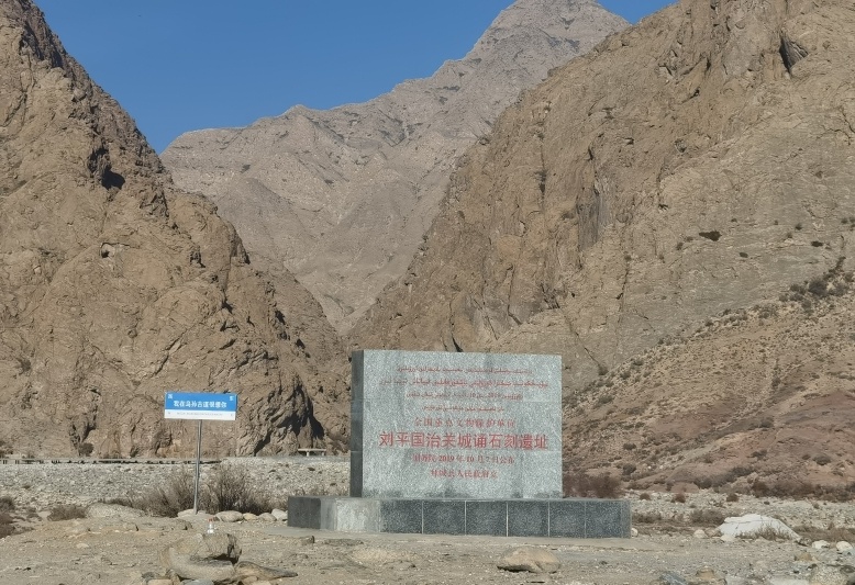
In 158 A.D., Liu Pingguo built a pass pavilion in the Baicheng area, which was one of the important means to consolidate the Han Dynasty's rule in the western region. This pass was located in the Bozikerige valley, the mouth of which was only twenty feet wide, with steep mountain walls on both sides, making it easy to defend and difficult to attack. Liu Pingguo in the construction of the pavilion here, can control the north and south of the border, but also to ensure the smooth flow of the Silk Road.
In the Bozhikerge out of the ditch on both sides of the river valley cliffs, there are the Eastern Han Yongshou four years (158 AD), the left general of the Guzi “Liu Pingguo rule Guanting Ode” Chinese script carvings. This stone carving and the surrounding Bozhikerge ancient camp, bunker sites, etc., are the Han Dynasty in the Wusun ancient road to build the remains of military facilities.
(4) Military operations of the Revolutionary Army of the Three Regions:
In 1945, the Revolutionary Army of the Three Regions started from Jongkushtai, passed through Akbulakdaban, and finally arrived at Heiying Mountain in Baicheng, which is also known as the Baozhadun Wusun ancient road. Here they established a base and turned to the west to launch an offensive, successfully capturing Baicheng. They then continued their march to the west, encountering stubborn resistance and counterattacks, but eventually captured the southern entrance of the Shatgudao and returned to Yili via the Shatgudao.
Numerous historical relics of the Wusun Ancient Road
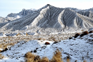
Wusun ancient road from south to north, canyons, and rocks stretching, mountains and glaciers are magnificent and colorful, forests and rivers are colorful and changing, ancient relics and nature's ghostly craftsmanship, sketching out a hundred-mile gallery with thousands of forms.
Heiying Mountain Site
Wusun ancient road south to Baicheng County Heiying mountain pass as the starting point, the pass was “V” shape, wide and narrow, both sides of the cliffs are steep and difficult to climb, the entrance is narrow and the rapids when the road, into the mountain road, is narrow, the strategic position is very important.
On both sides of the rock wall at the entrance, there are some square stone holes. Archaeologist Huang Wenbi once wrote an article to indicate the use: “The ancients built here in the past, cut holes in the rock to install a wooden latch or fence, open day and night to close, to check the pedestrians, the foreign enemy.”
Eastern Han Cliff Carving
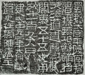
Within the Pass, there is an inscription carved on the cliff wall, known as the famous "Ode to Liu Pingguo's Ruling of the Pass Pavilion." The stone carving was first discovered in 1879. The inscription contains Liu Pingguo's record of daily affairs and words of blessing during his time stationed at the border crossing. This corresponds with historical records indicating that the establishment of the Western Region's customs began in the Western Han Dynasty, demonstrating the effective jurisdiction of the central government over the countries in the Western Region.
Garrison and Barracks
Not far from the Heiying Pass are the ruins of the garrison and camp, which were the supporting facilities for the pass. The soldiers formed a small team to rotate shifts at the pass, and most of them rested and were stationed there. Day and night with the whistling mountain wind and rushing river for company, garrison bitter cold can be imagined.
Raw and rough rock paintings
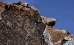
In the middle of the ancient road, 3100 meters above sea level, Akbulak near the strange stone forest, roadside distribution of many carved with the northern goat (also known as big-horned goat) rock paintings, archaeologists deduce that at least 3,000 years ago or so. In the northern part of the ancient road, from the mountainside to the foot of the mountain also several carved rock paintings, the image is still mainly bighorn sheep, with deer, horses, people, and so on. Among them are hunters with pointed hats, bows, and arrows, suspected to be Cypriot, the specific age to be examined.
Burials and Stone Men
From the high mountain weir in the middle of the ancient road, there are several ancient tombs along the Kuokesu River, and not far away, there is another tomb in front of which three stone slabs are placed in a circle, which may be an altar.
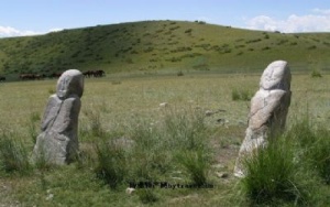
Not to be missed are the grassland stone men in the nearby valley.
The stone man has deep eyes and a beard, a big face with rough lines, a cup in his right hand, and a sword in his left hand, just like a leader. The stone man is the patron saint of the grassland and a witness to history, Xinjiang stone man has been found in more than 200, one-third of which is located in Tekes County.
Three Common Lines of Wusun Ancient Road
1. 2009-2012(An Shaohua etc. First Cross)
Qiongkushitai Village- Baozhadun darshan- Kuokesu River-Old liusuo- Heavenly Lake- Bozikerige River Valley- Heiying Mountain
2. 2013-2017(Sun Kewu etc. First Cros)
Wenquan- Kuokesu River- Longji- Heavenly Lake- Bozikerige River Valley- Heiying Mountain
3. 2018-Now
Qiongkushitai Village- Qiongdaban- Kuokesu River- New Liusuo- Heavenly Lake- Bozikerige River Valley- Heiying Mountain


