14th September
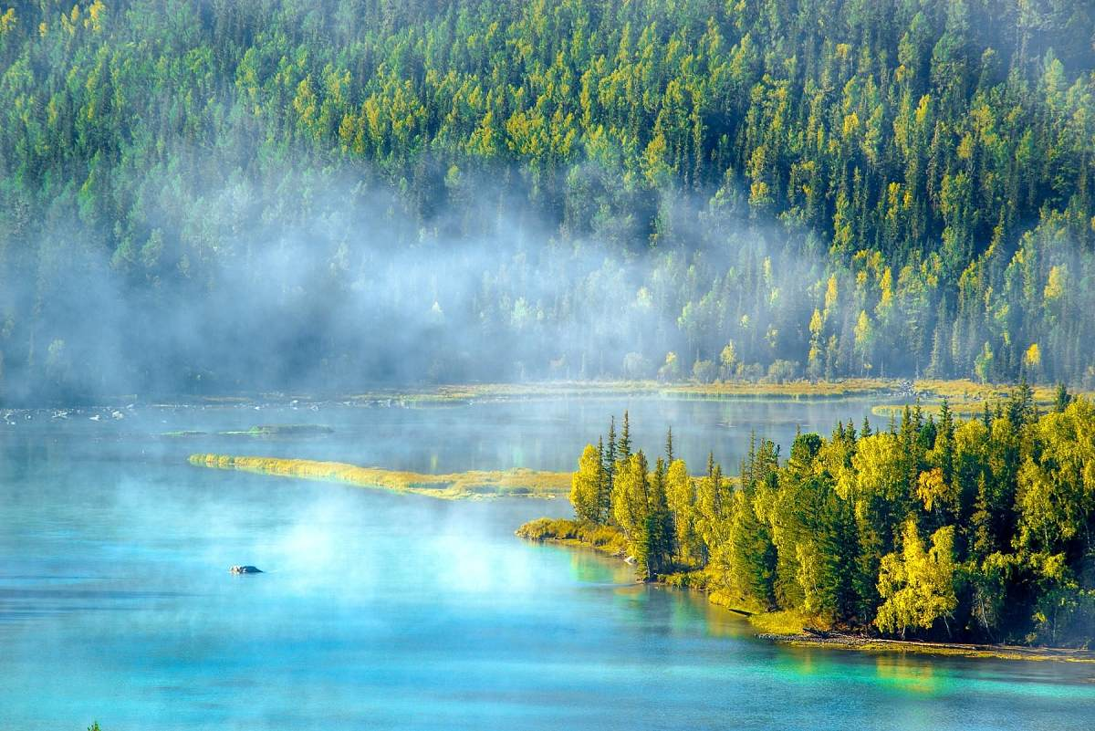
I woke up early to see the touted sunrise, but it was nothing special. Temperature was 5.2°C then. We went out together for a very simple porridge at the same restaurant as last night. We started out, retracing the route from yesterday back to Burqin, where we stopped for lunch. We ate near the Night Market area, and lunch was good with fish soup, fish in soy sauce, and lamb with asparagus with Prawn Sambal. We went back to Tourism Hotel to use the toilet before resuming the drive. It was a really long drive south towards Karamay and we saw the rich oilfields for many kilometers and thousands of oil donkeys. It was a warm sunny day. Our driver could not locate the Yilong Hotel with several tries till 8.50pm and it was dark when we arrived. Upon arrival at the Hotel, Anita quickly arranged dinner for all of us for 9.25pm. We put the bags down and popped down to the Hotel's Restaurant immediately. It was a decent meal after a long day and cost Yuan 40 each. Distance covered today was 520 km. Yilong Hotel was fairly new and good.
15th September
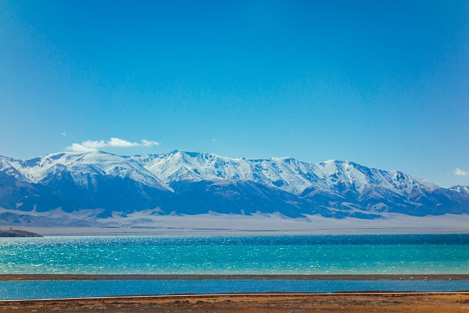
Next morning, I walked 5 minutes to the next road to buy beers, just in case our next Hotel was away from shops (True enough!). A big bottle of WUSU beer costs just Y 5 each in the towns everywhere. Breakfast in the same restaurant was good with choice of porridge and bread. We started out today at 9am and headed south towards Karamay, and Kuitun. Then, we turned West towards Jinghe. At 2pm, we stopped for lunch at a small Mongolian Restaurant along the Highway. Then at 5pm we arrived at Sayram Lake where we enjoyed ourselves at two stops with photos and watching the going-ons in the lovely bright sunshine and cool air. Sayram Lake side is 2060 m ASL.
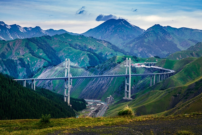
After an hour at the lake, we drove 10 minutes to the Long Lin Hotel, situated in a village away from everything. This village appeared to derive their electricity from Solar Panels thus explaining their controls on consumption. It commanded a wonderful view of the Valley and the special bridge- the highest elevation bridge in the world. It took 8 years to complete the 28 km highway. We checked in and then went for a walk outside to enjoy the cool atmosphere. We saw the Mongolian horsemen playing their sheep hunt on the steep slopes of the area. Back to the Hotel and some of us ate Dinner in its Restaurant at 7.40pm. We had “Finger Lamb” (a local specialty) and lamb soup, stir fried beef and a huge plate of chicken and veggies. Cost was Yuan 57 each. It was getting cold as we headed back to the room at 9.30pm. Hot water supply came at 9.45 pm for our showers. Due to an earlier guest's stupid setting on the shower head, our room had low water pressure. So, we used the sink and “mandi kampong”. It was OK and comfortable. That night, it was 17°C in the room, but 6.5°C outside at dawn. Distance travelled today was 490 km.
16th September
We had breakfast of porridge and mantou in the Hotel, but were told we would be skipping lunch. So everyone boiled water to make cup noodles in the bus to eat with takeaway mantou. We left the Hotel and headed into the Tunnel at the start of the 28 km special Highway of the Fruit Valley (Guojigou Valley). It was scenic but we could not take photos due to poor lighting and raindrops on the windows. We were in the bus from 9.10am till we got to Nalati Grassland at 3.15pm and it rained quite heavily during the whole journey. We all ate our little lunches on the bus at 1.30 pm. and toilet stops were nasty affairs in the remote areas. The distance covered was 510 km.
At Nalati, we took their shuttle bus to the scenic areas, but with the rain becoming increasingly heavy, there were few takers to get off. Only Yoke Lin and I walked a bit, but it was too wet and cold to enjoy. So we went back to the Visitors Centre and shopped around, of course! From there, we drove another 15 km to our Hotel, Heyang Hotel. We had a hot shower and then went out in the rain for the Dinner at the Hotel's restaurant which a substitute for the missed lunch today. The food was simple and not great. Over dinner Ayeesha received news that Bayanbulak Park and the Road 217 were closed today due to heavy snowfalls. We discussed alternatives should the situation not improve the next day, meaning that we may have to head straight for Korla. The elevation of Nalati is 1485 m ASL. That night at 8pm, the temp was down to 6.5°C. Two more buses arrived at the hotel later that night. It was still raining at midnight when I went to sleep.
17th September
Jumped out of bed at 7am, and opened the window to a beautiful clear sky and a dry day!! How very lucky!! Today's sunrise at 7.30 am was the nicest so far and the sun's rays gradually coloured the snow capped mountains with an orange glow. Temperature was just 5°C. Due to the heavy snowfall yesterday, the scenery had changed dramatically with snow at lower heights as well. I went down for the simple breakfast at 8.10am and looked for camera angles. The best place for photos was still from our room window. We started out at 9am, and the Driver had to backtrack a few km to fill gas. This gave us the chance to look at Nalati Park in the dry sunshine and it was beautiful today. And more photos were taken.
Today's drive was only 80 km to Bayanbulak, but we took a really long time.
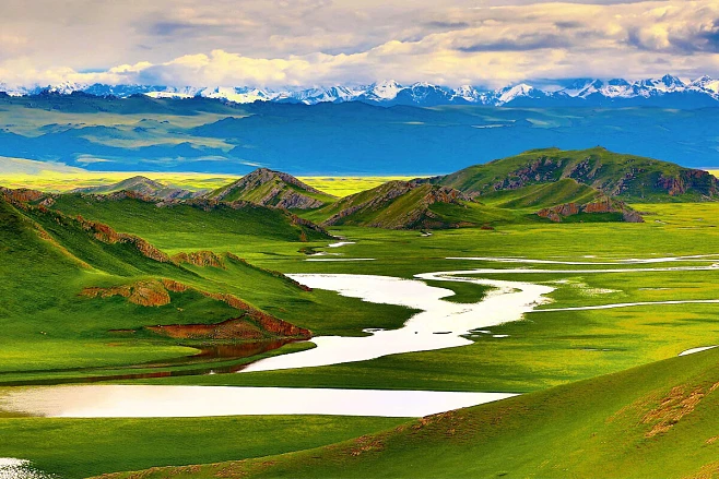
No-one complained because the views were stunning. Snow covered a lot of the highlands and the pine trees had snow on the branches, all very photogenic. Everyone took more photos than they had expected with some getting their batteries flat by 11am - shorter battery life in the cold made it worse! The Tian Shan Mountains were amazingly beautiful in the clear blue skies. We stopped at several scenic spots for photos, purchases of honey, pollen etc, and snowball-fights. The snow was really clean and white, and I ate some of it too. The road condition in the snow was very good and did not appear dangerous, and we drove slowly too. After reaching the very top of the pass at 2800 m ASL, we started going down the other side. Immediately the bus went into cloud cover for 30 minutes. We saw some yak here for the first time. Then, we reached the junction of Roads 217 and 218. And 218 was OPEN –and not surprising as it was a bright sunny day. We reached Bayanbulak town at 12.20pm and headed straight for lunch at the Bayan Hotel's restaurant.
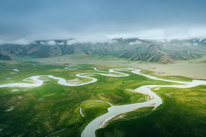
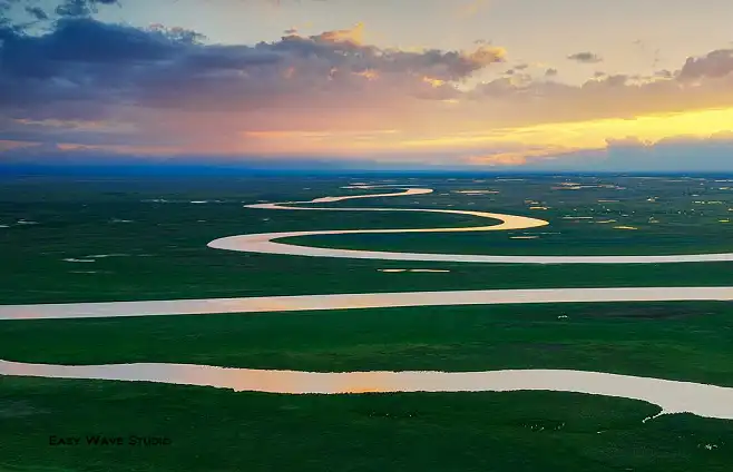
After lunch, we took 4 minutes to reach Bayanbulak Park ticket office. Then we were driven in shuttle buses some 45 km into the Park. First stop was for the Swan Lake. The boardwalk still had some snow on it as we walked to see the Whooper Swans, but only about 12 of them were there. At the final bus stop, we opted to walk 3 km to the scenic spot up a very gentle gradient on a snow covered boardwalk. It was easy-going and a nice change from sitting for long hours in the bus. We saw the Mongolian sheep with black heads and Mongolian horses with shorter legs on the way. Then we got to the spot and enjoyed lovely weather. Some Egyptian Vultures were out hunting and gave us great views. Elevation here was 2460 m ASL. Then, some decided to take the electric vehicle back while the others walked. Back out of the park and to the Bayan Hotel for check-in.
That night at 8pm, only 6 of us walked out to Bayanbulak town to scout around and have dinner. We chose a small clean Hui Restaurant that had a heater device in the dining hall. We ordered a bit too much and way too spicy (chicken, lamb, and veggies) with boiled hand-made noodles. Sadly, Matthew got sick the next day. It was very cold when we walked back. Luckily the room was heated and it was 21°C at 10pm. Elevation here was 2350 m ASL – the highest elevation for a night stop. Outside the mercury fell to 2.2°C at midnight. So it was very comfortable and a nice end to a most enjoyable day.
18th September
I woke up at 7am and measured the outside temperature to be minus 0.6°C. In the room, it was still 17°C even though the heating was said to have stopped after 1am. We went down for a simple porridge breakfast. Before we loaded the bags in the bus, the driver was seen boiling water to pour onto the fuel injectors of the bus engine. We all lent a helping hand by giving him all the hot water we had to get the engine started. It worked, and then the ladies got back to the rooms to boil more water for our lunch on the bus later today.
The guys loaded the luggage onto the bus. We started at 9.15am, after a 30 minutes delay. The first part of the journey was a retracement back to the junction of Roads 217 and 218. The visibility was down to 80 metres only in the early morning mist for half hour. Then, we followed Road 218 and it was long straight stretches of good road with Tian Shan Range on both sides of the road, with flat plains for some 2 kilometers.
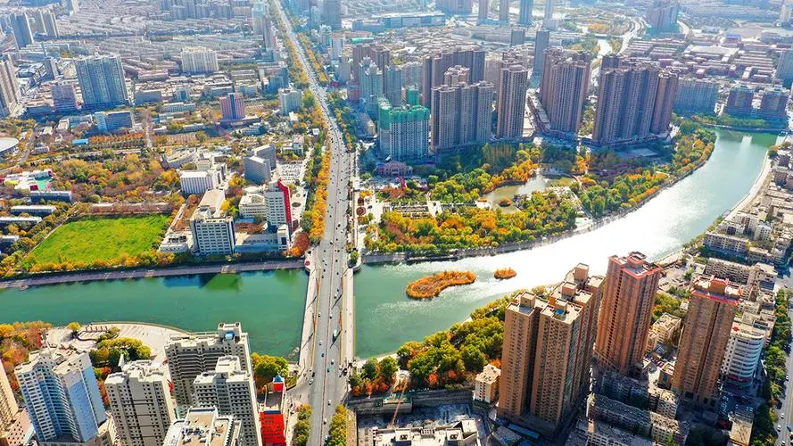
This was another nice sunny day. We reached an elevation of 3200 m ASL but we hardly felt any rise due to gradual ascents. We followed the Kaidu River for long parts of the drive before descending to Korla. We ate lunch on the bus somewhere along the route. We finally reached Korla at 4.10pm after a 7 hours drive and 3 bad toilet stops. Elevation of Korla is just 950 m ASL and it was just cool in the shade as we visited the Iron Gate Pass. This was an important and strategic pass in the old Silk Road days.
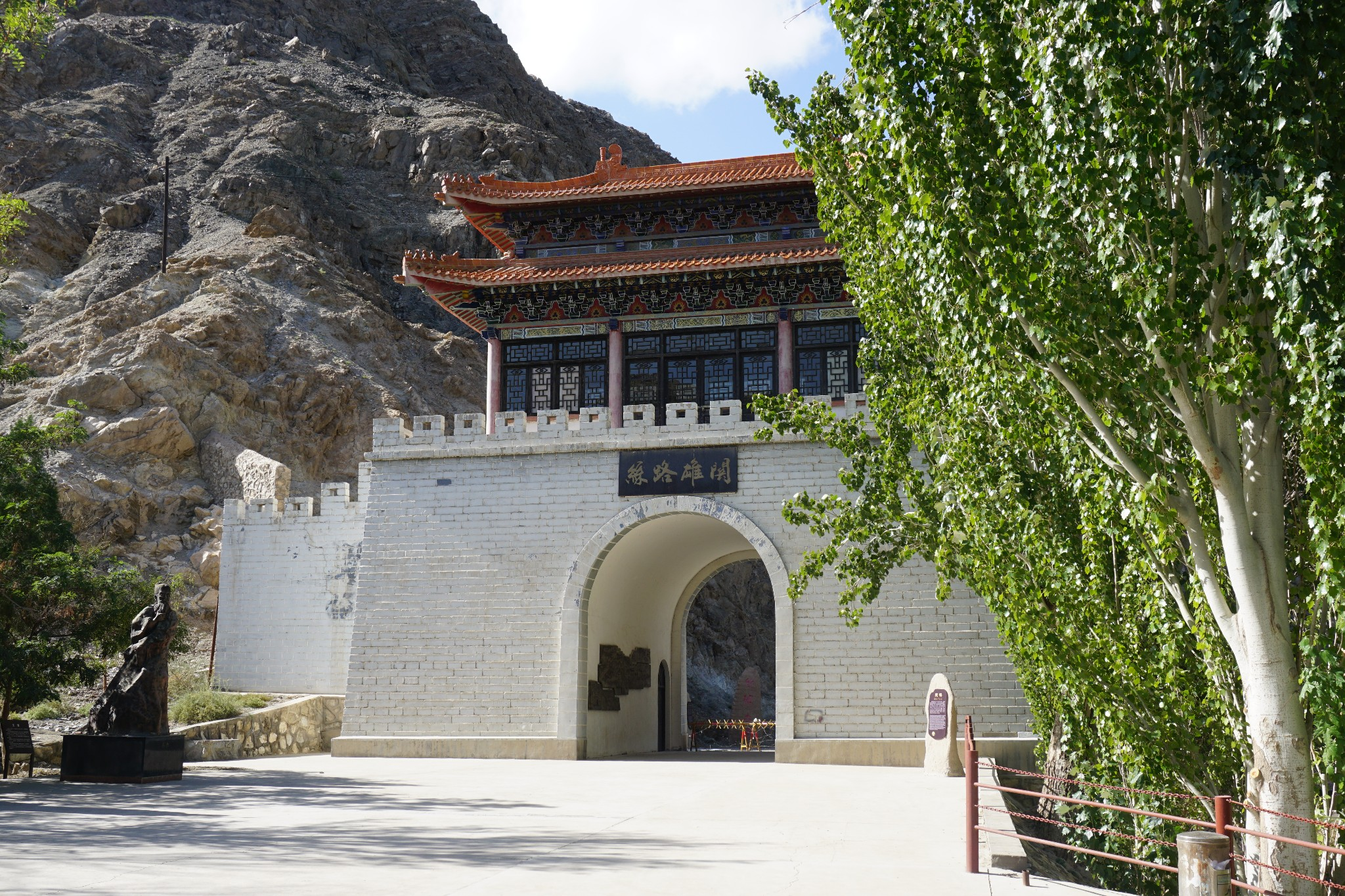
Then check in at 6pm to Kaidu Hotel, a nice high rise modern hotel. We were treated to a nice dinner as substitute to the missed lunch at the Restaurant next door at 7pm. Food was very nice and different from previous days', but service was unfortunately slow. The highlight was great lamien noodle in spicy soup topped up with melons as dessert. Lai Yeastman bought 2 bottles of local Red wine and those were happily enjoyed. After dinner, we walked down to the Peacock River, which was almost dry. After a while, we headed back. We travelled 390 km today.
To Be Continued...


